Precision Aerial Services: Surveys, Photography, and Videography in Nashville
Unparalleled Insight From Tennessee's Sky
For any advanced aerial survey requirements across Tennessee, Nashville Helicopter Charters delivers comprehensive solutions, expertly integrating the precision hover and low-altitude flight capabilities inherent to helicopters. We facilitate critical data acquisition for magnetometer and electromagnetic surveys, detailed LiDAR mapping, and accurate GIS mapping initiatives. Furthermore, our specialized aerial filming services equip productions with cutting-edge cinematography and photography technology, offering options from sophisticated gyro-stabilized mounts to practical door-off configurations for handheld camera work. We ensure superior visual data capture for film, television, or precise commercial imaging projects, providing unmatched versatility and optimal vantage points over the Tennessee landscape.
Aerial
Surveys
LiDAR, GIS Maps, FLIR, HD Video & More
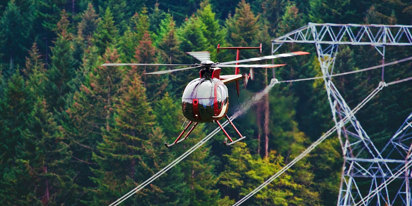
Nashville Helicopter Charters provides indispensable aerial support for critical infrastructure projects, including comprehensive pipeline surveys, precise Right-of-Way (ROW) inspections, and proactive transmission line patrols. We ensure your project's success by deploying optimal aircraft configurations, integrating state-of-the-art specialized equipment, and connecting you with highly experienced operational teams. This comprehensive approach guarantees efficient and accurate completion of demanding tasks across Tennessee.
High Tech Results
The Top Pilots in Tennessee, Today's Technology... Maximum Results.
Call 615-649-6222 Now!
Nashville Helicopter Charters provides the tools needed to complete your land surveys, utilizing the right equipment to provide the aerial photos that are often needed.
Effective aerial surveys profoundly simplify complex data acquisition for critical commercial and infrastructure projects in Tennessee. This method makes Right-of-Way and site inspections, the precise gathering of topographical data, and high-definition aerial imaging remarkably efficient. Helicopter surveys are unparalleled for comprehensive terrain assessment, detailed pipeline leak detection, proactive identification of transmission line anomalies, and acquiring high-resolution video and photographic documentation of properties across the state. Nashville Helicopter Charters specializes in designing and implementing bespoke photographic and remote sensing operations, meticulously custom-fitted to maximize both technical precision and financial efficiency, ensuring superior actionable results for your enterprise.
The inherent operational characteristics of helicopters make them the premier platform for precision aerial surveying. Unlike fixed-wing aircraft, constrained by FAA regulations to maintain a minimum of 1,000 feet above obstacles, helicopters possess the unique capability to conduct sustained low-altitude flight and precision hovering. This allows for meticulous data capture and visual inspection of infrastructure and terrain with unmatched detail. Furthermore, helicopters provide engineers and project managers safe access to visually inspect inaccessible, hazardous, or complex geographical zones across Tennessee, yielding critical perspectives and data that are simply unattainable through any other aerial means.
There is no better way to conduct your visual survey, animal population counts, soil drainage analysis, ROW inspections, pipeline and transmission line inspections, and geographical surveys.

LiDAR Imaging
Light Detection and Ranging, or LiDAR, is a remote sensing method used to examine and measure Tennessee topography as well as objects, like vegetation, upon it.

Infrared Imaging
Thermographic IR cameras are used to detect radiation in the long-infrared range of the electromagnetic spectrum and produce images of that radiation, called thermograms.

HD Video Gimbal Capture
Modern HD and 4K cameras can be mounted to helicopters, using the proper STCs, with a gimbal to stabilize photos & videos for detailed results.
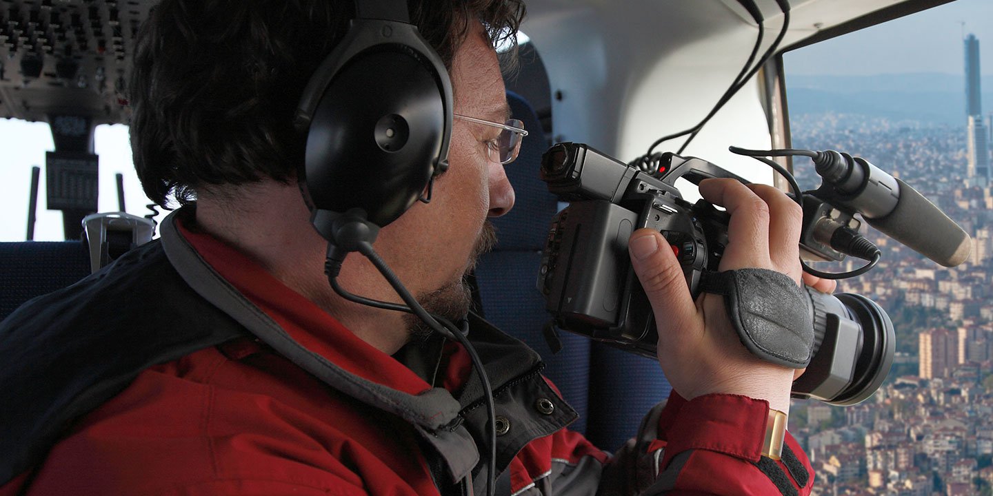
Cutting-Edge Aerial Filming and Expert Videography Services
For expert camera work in the Nashville Sky
Get a Fast, free QuoteNashville Aerial Cinematography
Nashville Helicopter Charters provides unparalleled access to a comprehensive suite of professional-grade aerial cinematography resources throughout Tennessee, empowering your production with cutting-edge capabilities. Our extensive network facilitates custom shoots, integrating the latest advancements in gyro-stabilized camera mounts, including industry-standard systems such as Tyler Mounts, Wesscam, Cineflex, Pictorvision, and SpaceCam. We pair these with high-performance specialty cameras like Cineflex HD, RED Epic, and Arri Alexa, alongside advanced 3D and experimental camera options, ensuring your creative vision is fully realized. We adeptly support all facets of your production goals, from dynamic air-to-air sequences to intricate ground-to-air perspectives. Our experienced operational teams collaborate closely with aerial Directors of Photography and directors, delivering the precise visual results demanded by the most discerning productions. Specializing in helicopter services for both still and motion photography, Nashville Helicopter Charters is equipped to facilitate nearly every media-related operation across Tennessee. This includes feature films, television series, documentaries, impactful promotional videos, high-budget commercials, aerial props for dramatic effect, critical relief work for broadcast networks, and comprehensive coverage of historical events and major sporting spectacles, all achieved with a diverse fleet of highly adaptable helicopters.
Call Us Today at 615-649-6222 for a Free Quote
Contact Us
Aerial Photos
Hand-held or Mounted OpTions in Nashville
We will help you get the right equipment for your aerial photography project! Call 615-649-6222 today to get a fast, free quote.
The Most Options for Photography
To truly capture the spectacular settings and breathtaking vistas throughout Tennessee, an aerial perspective is indispensable for professional photographers and filmmakers. Nashville Helicopter Charters curates bespoke aerial photography charters meticulously designed to exceed creative expectations, enabling the precise realization of your artistic vision. We are committed to providing clients with highly cost-effective and accessible photographic opportunities across the Tennessee landscape. For dynamic, handheld projects, many helicopters can be configured with door-off operations, offering an an unobstructed field of view. For productions demanding superior stability and precision, we encourage inquiries regarding our advanced gyro-stabilized camera mount solutions, ensuring unparalleled image quality and cinematic smoothness for every frame.
Superior Service
Every one of our customers gets a dedicated helicopter expert to assist with flight plans, tech loadouts, production logistics, project schedules, and other demands.
Over 500 Aircraft
Our network of direct air partners extends well beyond Nashville, Tennessee. This allows us to offer a wide range of solutions for even the most sophisticated projects.
The Best Equipment
From high-tech sensors like LiDAR, FLIR, and GIS to HD cameras and movie production gimbals, we're here to make your job as easy as possible.